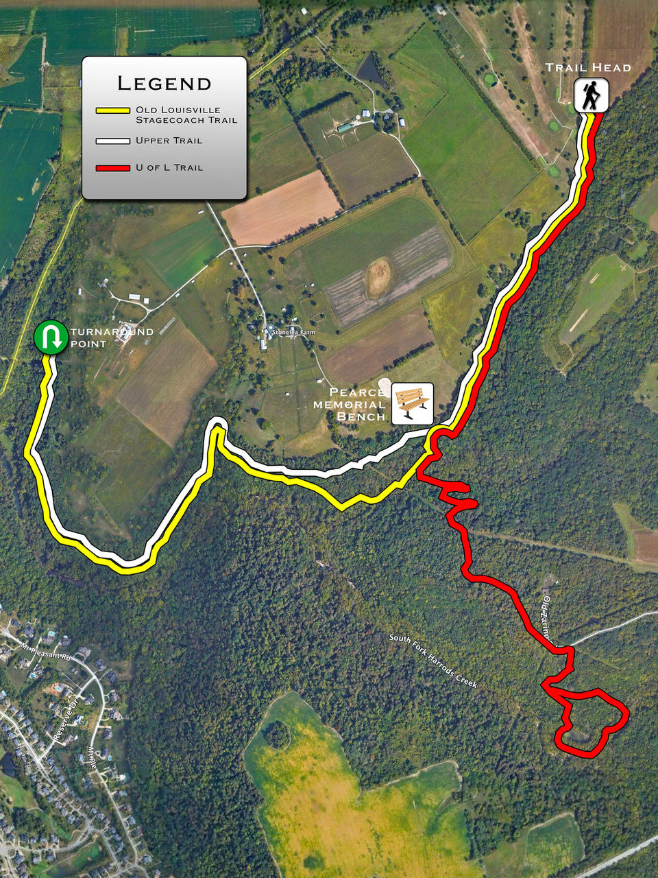
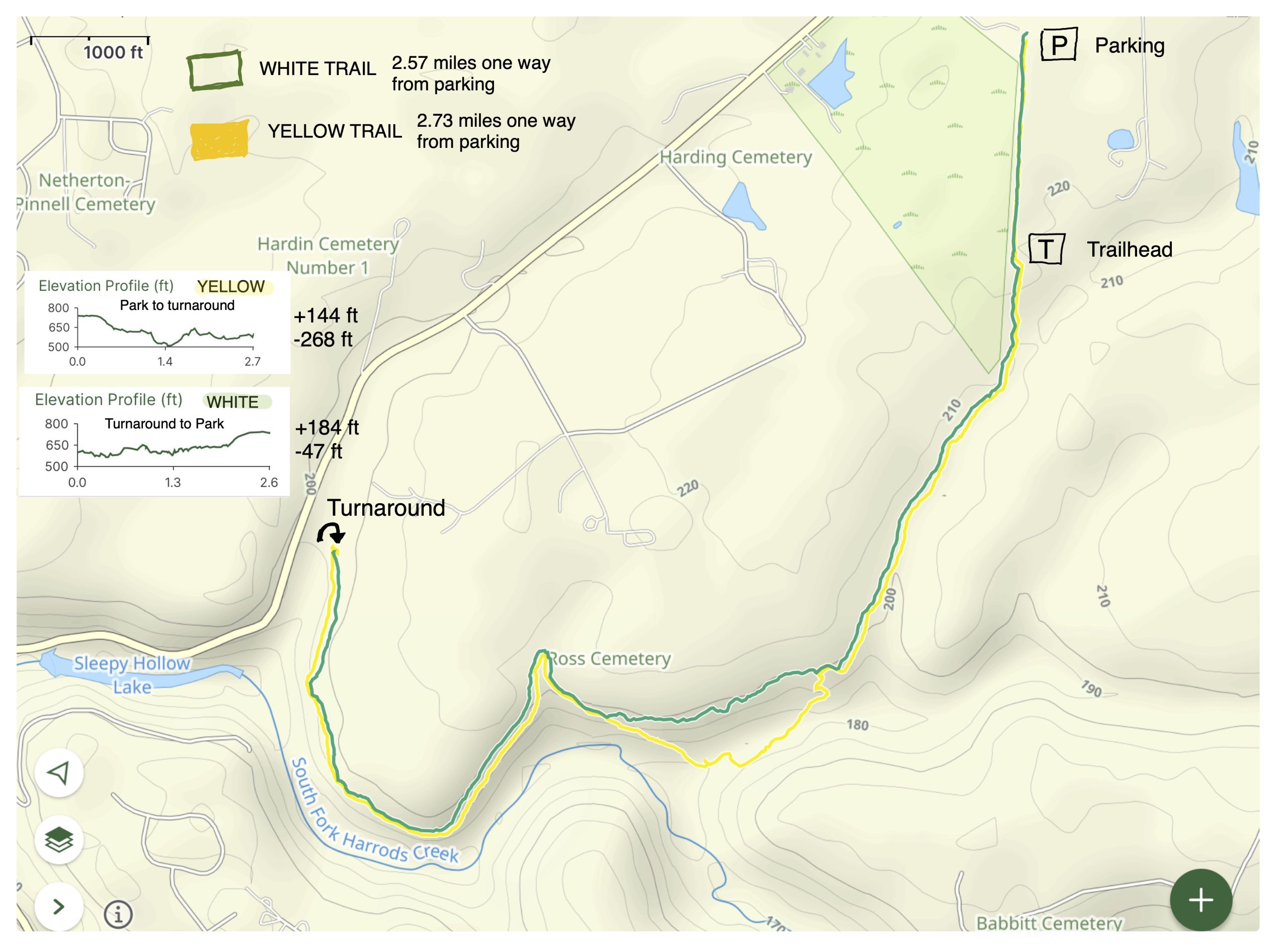
Trail Maps
Please choose from one of the maps below. Thanks to Eagle Scout Candidate Chris Paris for the Trail Overview Map, and thanks to BATA Member Rick Waggoner for the two Topographic Maps!
Trail Overview Map
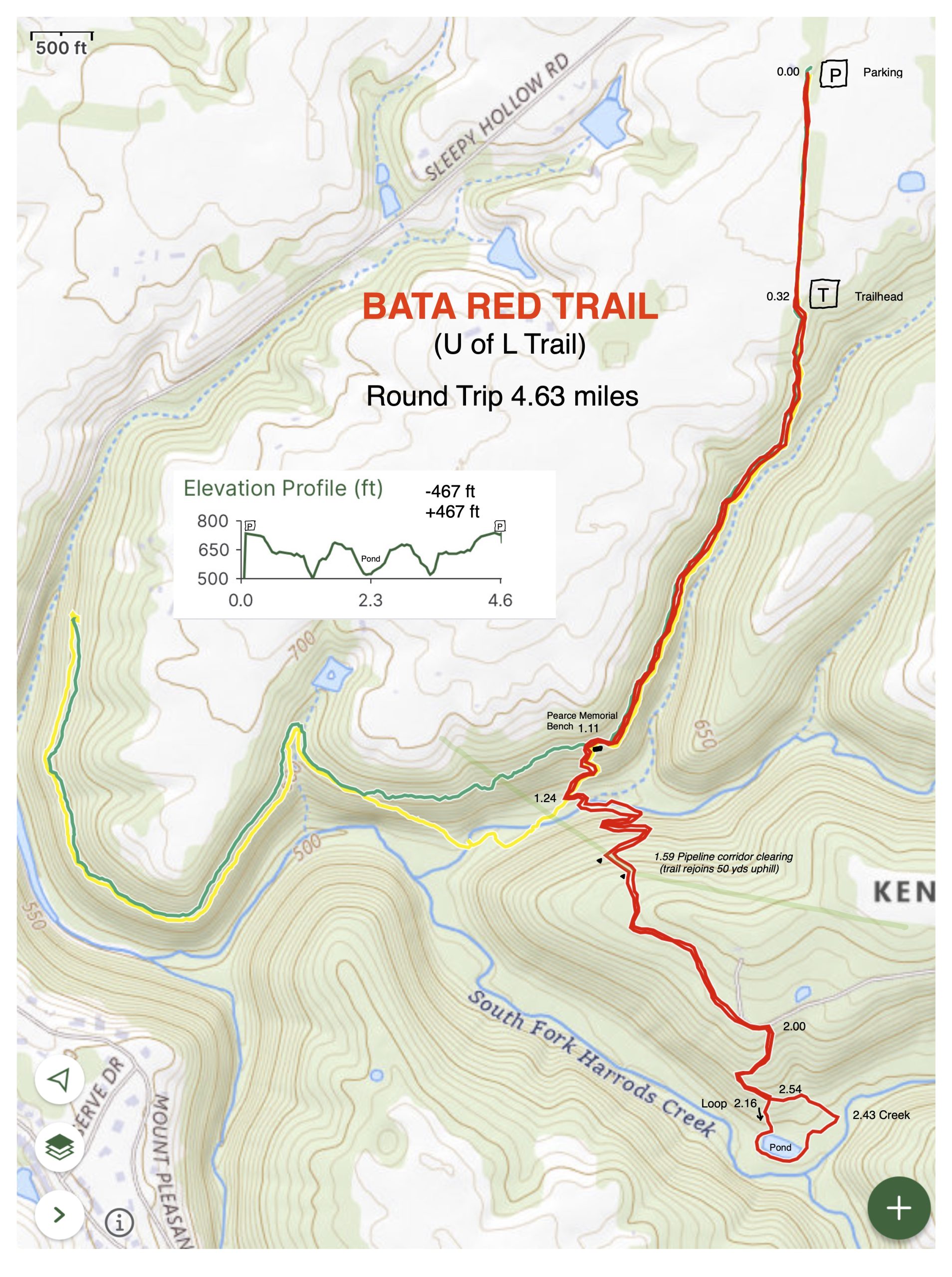
Red Trail Topographic Map

Please choose from one of the maps below. Thanks to Eagle Scout Candidate Chris Paris for the Trail Overview Map, and thanks to BATA Member Rick Waggoner for the two Topographic Maps!